Antique Map of North America, Early Texas Republic & Russian Alaska - 1839
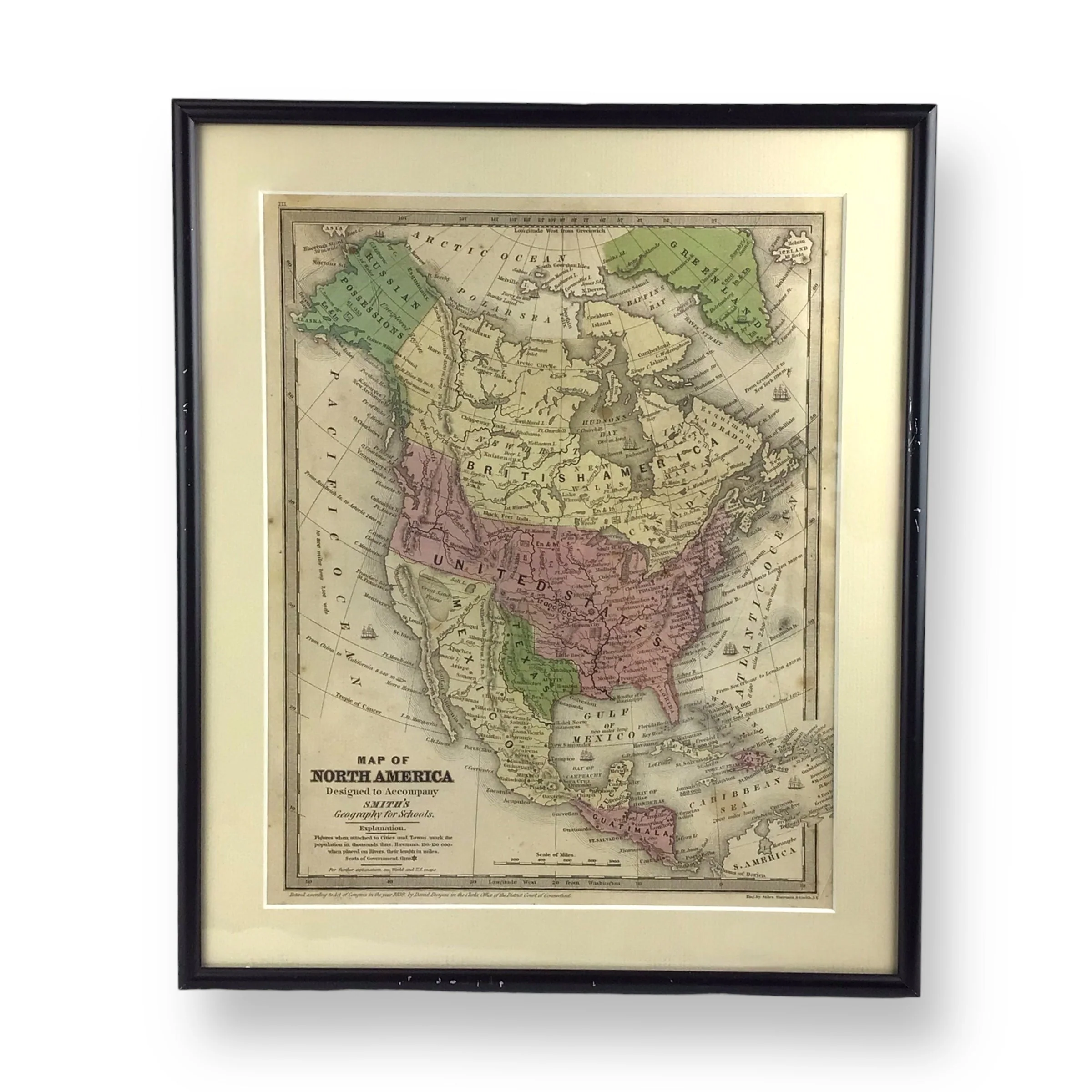
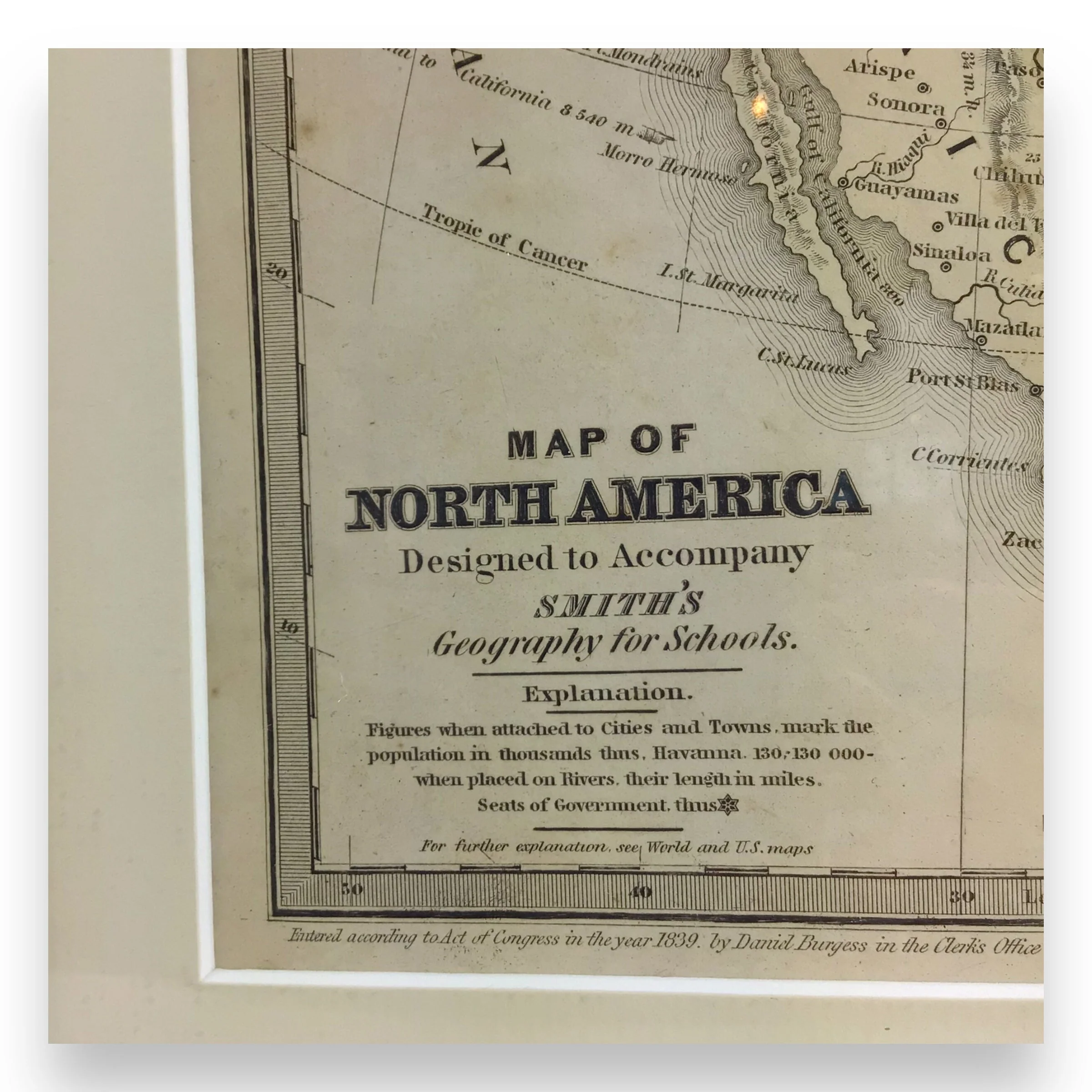
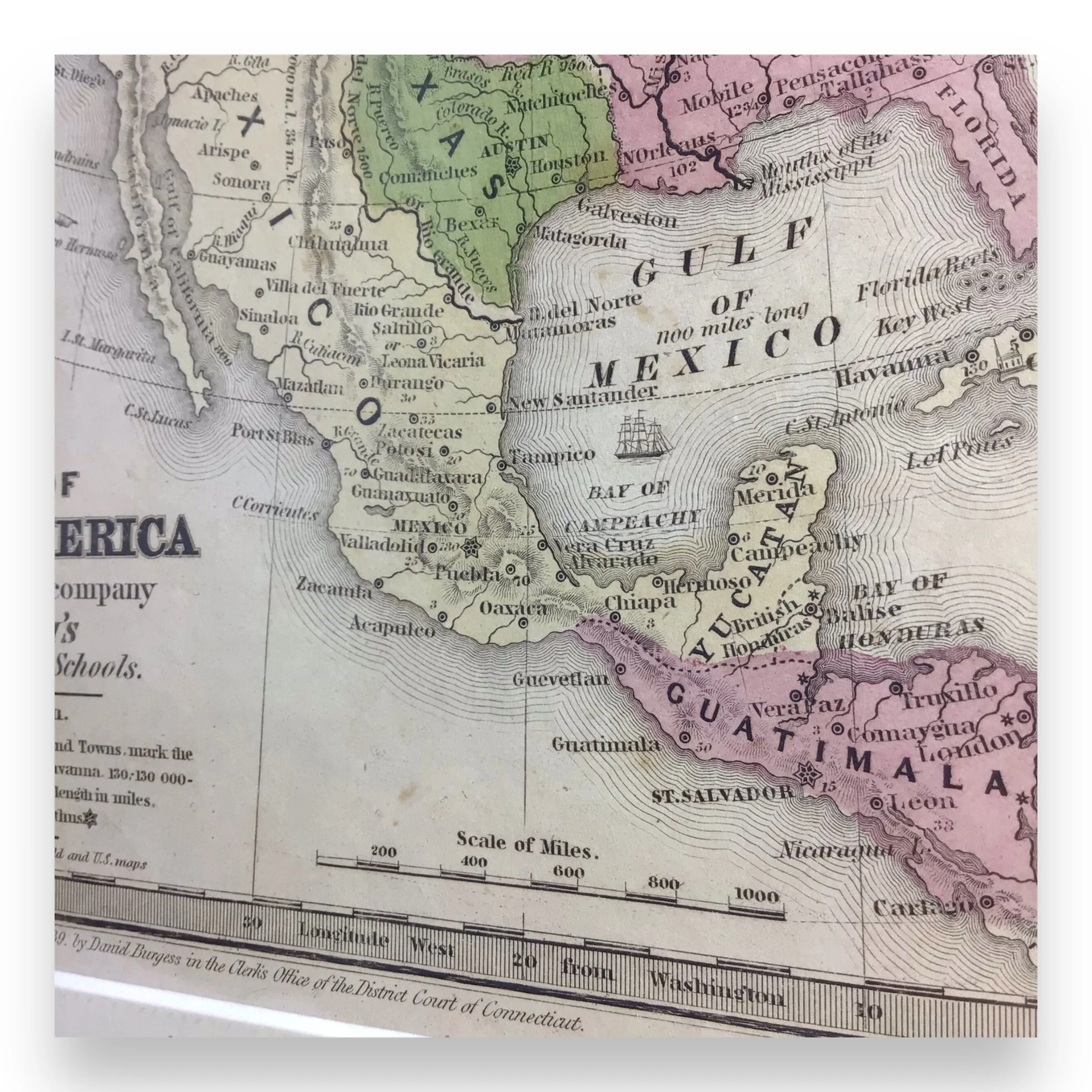
This stunning Antique Map, titled "Map of North America" from Smith's Geography for Schools (1839), is a fascinating representation of early 19th-century America, just before the Texas War of Independence and while Alaska was under Russian control. This beautifully copper-engraved, hand-colored map shows Mexico extending northward into what is now California, and highlights Texas as an independent republic with Austin as its capital. The United States is shown with a population of 17 million, while Alaska is marked as "Russian Possessions," with the region noted as "Unexplored."
The map also showcases early place names such as St. Francisco, Monterrey, St. Diego, and Albuquerque, with a particularly unique placement of "St. Louis" near Santa Barbara, a name not seen elsewhere. The Great Basin is labeled as the "Great Sandy Plains," and the Great Salt Lake appears too far east, simply labeled as "Salt L."
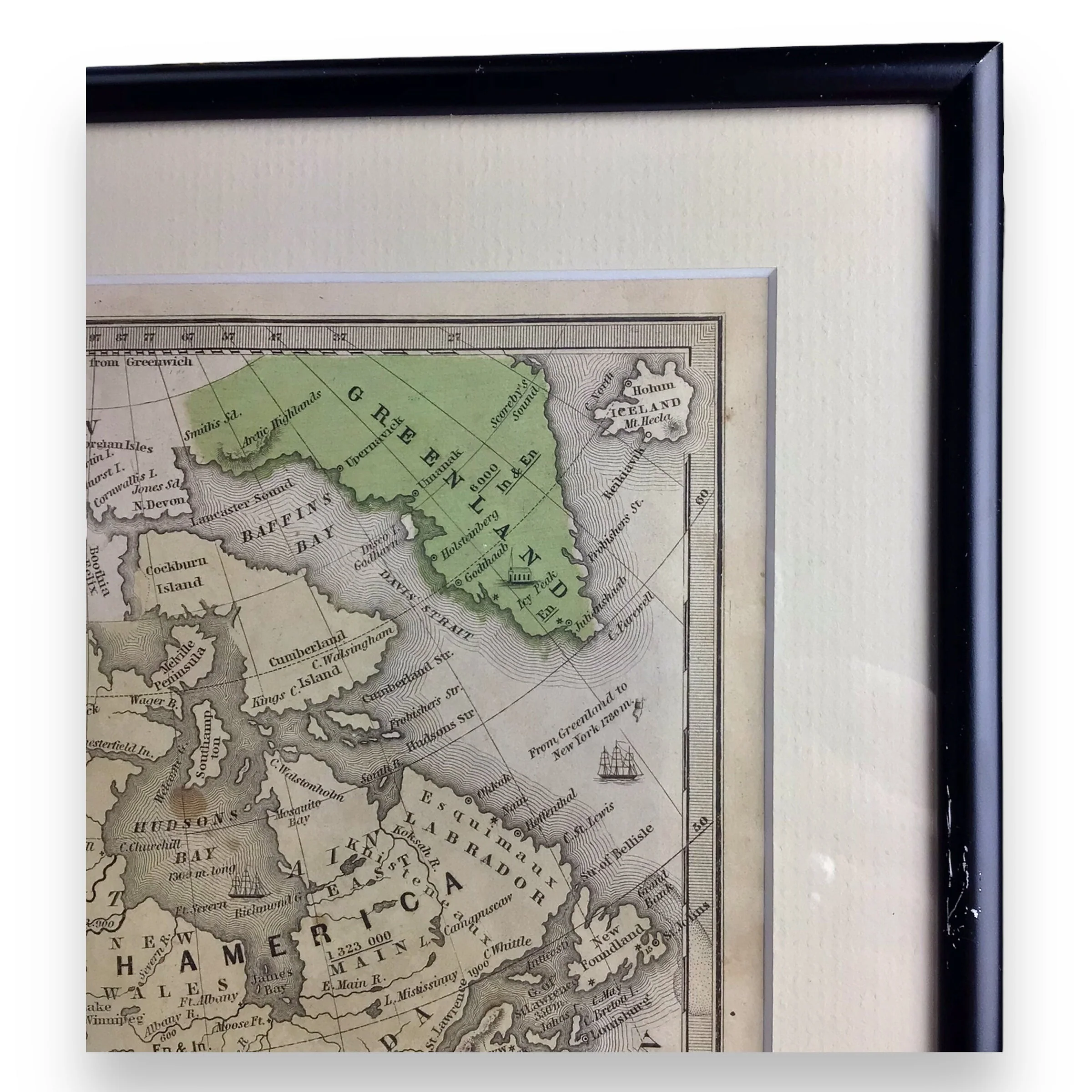
An early map of political and geographic significance, this piece offers insight into the cartographic and territorial disputes of the period. The map extends to include Greenland, Central America, and the Caribbean, giving a broad view of North America at a time of critical change. A true historical treasure, perfect for collectors of early American maps and period cartography.
Key Features:
- Hand-colored copper engraving from the Smith’s Geography for Schools, 1839
- Depicts the independent Republic of Texas, with Austin as its capital, separated from the United States
- Shows Mexico controlling the Southwest and California up to the 42nd parallel
- Alaska marked as "Russian Possessions," with large blank areas indicating unexplored regions
- Shows U.S. population at 17 million and the nation’s territorial claims extending into Canada to the 55th parallel
- A rare map featuring early place names such as "St. Louis" near Santa Barbara and "New Britain" as the name for Canada
- Great political and historical significance, reflecting U.S.-British territorial tensions in the Northwest and Mexican control of the Southwest
- Map extends to include Greenland, Central America, and the Caribbean, providing a broader geographical insight to the times
Condition: The map is in excellent condition with vivid hand-colored engravings. Still beautifully preserved in its original frame, with crisp lettering throughout. The outer edges show some slight foxing, all displayed in the images, typical for a map of this age, but remains vibrant and well-preserved for display or showcasing.
Item Dimensions:
- Map: 10.85" H x 8.75" W
- Framed Map: 13.60" H x 11.40" W
Item Location: Collectors Crossroads - QM0093
Product Information
Product Information
Shipping & Returns
Shipping & Returns





Antique Map of North America, Early Texas Republic & Russian Alaska - 1839
Antique Map of North America, Early Texas Republic & Russian Alaska - 1839
This stunning Antique Map, titled "Map of North America" from Smith's Geography for Schools (1839), is a fascinating representation of early 19th-century America, just before the Texas War of Independence and while Alaska was under Russian control. This beautifully copper-engraved, hand-colored map shows Mexico extending northward into what is now California, and highlights Texas as an independent republic with Austin as its capital. The United States is shown with a population of 17 million, while Alaska is marked as "Russian Possessions," with the region noted as "Unexplored."
The map also showcases early place names such as St. Francisco, Monterrey, St. Diego, and Albuquerque, with a particularly unique placement of "St. Louis" near Santa Barbara, a name not seen elsewhere. The Great Basin is labeled as the "Great Sandy Plains," and the Great Salt Lake appears too far east, simply labeled as "Salt L."
An early map of political and geographic significance, this piece offers insight into the cartographic and territorial disputes of the period. The map extends to include Greenland, Central America, and the Caribbean, giving a broad view of North America at a time of critical change. A true historical treasure, perfect for collectors of early American maps and period cartography.
Key Features:
- Hand-colored copper engraving from the Smith’s Geography for Schools, 1839
- Depicts the independent Republic of Texas, with Austin as its capital, separated from the United States
- Shows Mexico controlling the Southwest and California up to the 42nd parallel
- Alaska marked as "Russian Possessions," with large blank areas indicating unexplored regions
- Shows U.S. population at 17 million and the nation’s territorial claims extending into Canada to the 55th parallel
- A rare map featuring early place names such as "St. Louis" near Santa Barbara and "New Britain" as the name for Canada
- Great political and historical significance, reflecting U.S.-British territorial tensions in the Northwest and Mexican control of the Southwest
- Map extends to include Greenland, Central America, and the Caribbean, providing a broader geographical insight to the times
Condition: The map is in excellent condition with vivid hand-colored engravings. Still beautifully preserved in its original frame, with crisp lettering throughout. The outer edges show some slight foxing, all displayed in the images, typical for a map of this age, but remains vibrant and well-preserved for display or showcasing.
Item Dimensions:
- Map: 10.85" H x 8.75" W
- Framed Map: 13.60" H x 11.40" W
Item Location: Collectors Crossroads - QM0093
Original: $638,300.00
-70%$638,300.00
$191,490.00Product Information
Product Information
Shipping & Returns
Shipping & Returns
Description
This stunning Antique Map, titled "Map of North America" from Smith's Geography for Schools (1839), is a fascinating representation of early 19th-century America, just before the Texas War of Independence and while Alaska was under Russian control. This beautifully copper-engraved, hand-colored map shows Mexico extending northward into what is now California, and highlights Texas as an independent republic with Austin as its capital. The United States is shown with a population of 17 million, while Alaska is marked as "Russian Possessions," with the region noted as "Unexplored."
The map also showcases early place names such as St. Francisco, Monterrey, St. Diego, and Albuquerque, with a particularly unique placement of "St. Louis" near Santa Barbara, a name not seen elsewhere. The Great Basin is labeled as the "Great Sandy Plains," and the Great Salt Lake appears too far east, simply labeled as "Salt L."
An early map of political and geographic significance, this piece offers insight into the cartographic and territorial disputes of the period. The map extends to include Greenland, Central America, and the Caribbean, giving a broad view of North America at a time of critical change. A true historical treasure, perfect for collectors of early American maps and period cartography.
Key Features:
- Hand-colored copper engraving from the Smith’s Geography for Schools, 1839
- Depicts the independent Republic of Texas, with Austin as its capital, separated from the United States
- Shows Mexico controlling the Southwest and California up to the 42nd parallel
- Alaska marked as "Russian Possessions," with large blank areas indicating unexplored regions
- Shows U.S. population at 17 million and the nation’s territorial claims extending into Canada to the 55th parallel
- A rare map featuring early place names such as "St. Louis" near Santa Barbara and "New Britain" as the name for Canada
- Great political and historical significance, reflecting U.S.-British territorial tensions in the Northwest and Mexican control of the Southwest
- Map extends to include Greenland, Central America, and the Caribbean, providing a broader geographical insight to the times
Condition: The map is in excellent condition with vivid hand-colored engravings. Still beautifully preserved in its original frame, with crisp lettering throughout. The outer edges show some slight foxing, all displayed in the images, typical for a map of this age, but remains vibrant and well-preserved for display or showcasing.
Item Dimensions:
- Map: 10.85" H x 8.75" W
- Framed Map: 13.60" H x 11.40" W
Item Location: Collectors Crossroads - QM0093